Heatwave conditions are looming over much of South Australia, Victoria, and inland NSW, while central Queensland prepares for severe flooding.
Heatwave conditions are looming over much of South Australia, Victoria, and inland NSW, while central Queensland prepares for severe flooding.
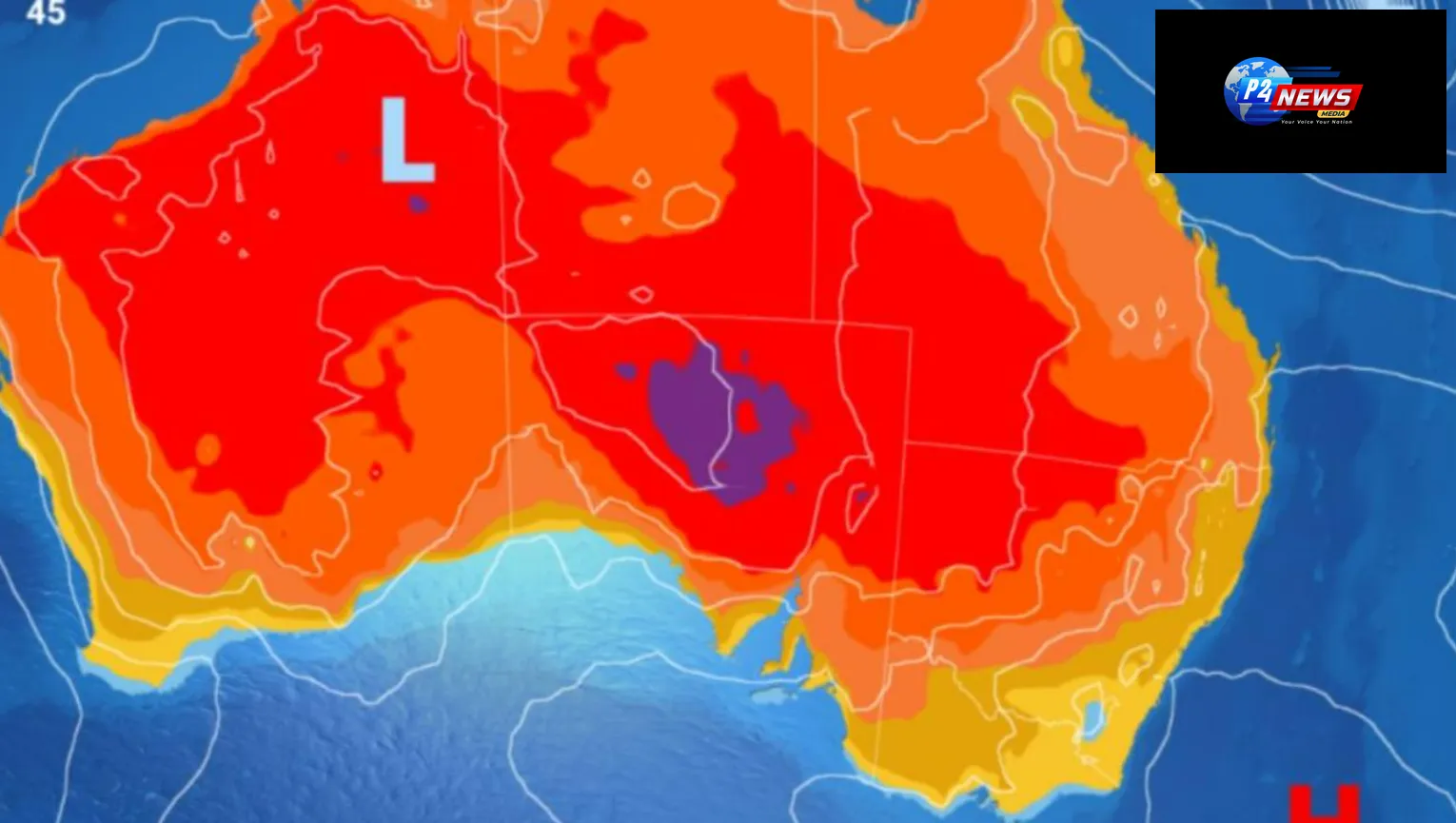
This weekend, a significant heatwave is anticipated to impact various regions of Australia, particularly New South Wales (NSW) and Victoria, where temperatures could reach alarming heights of 36°C. The country's east coast is poised to experience a scorching period, with forecasts indicating that temperatures will climb as much as 12°C beyond what is typically anticipated for this time of year.
The Bureau of Meteorology has released a severe heatwave alert for substantial sections of Victoria and New South Wales, with Melbourne expected to witness two consecutive days of high temperatures, peaking at 36°C on both Friday and Saturday. This extreme weather will predominantly affect the inland regions of NSW; however, Sydney appears to be somewhat shielded from the worst of the heat, with temperatures projected to range from 25°C to a maximum of 30°C from Friday to Tuesday.
In Melbourne, the temperature on Friday will start at a high of 34°C and jump to 36°C on Saturday before dropping significantly to around 21°C with rain on Sunday. Meanwhile, provinces like Bendigo and Maryborough could also see temperatures soaring to 36°C, while towns such as Edenhope and Nhill may even reach 37°C on Friday.
Looking further north, inland NSW is bracing itself for temperatures in the mid to upper 30s, with border towns like Mildura and Cobram possibly experiencing highs of 38°C. Nighttime minimums on Friday are expected to remain elevated, not dropping below 22°C in Melbourne or dipping below 28°C in certain regions of South Australia, including Port Augusta.
In south-eastern NSW, regions like Griffith, Forbes, and Ivanhoe are projected to grapple with temperatures exceeding 35°C for several consecutive days, extending into Monday. This ongoing heat wasn't merely a forecast; Thursday saw Adelaide hit 34°C, with large areas of South Australia surpassing the 40°C mark, an increase of between 5°C and 15°C over average temperatures.
By Friday, the capital is poised to reach a high of 36°C, with similar readings expected in the eastern and inland territories of South Australia. Places like Tarcoola and Oodnadatta might also see maximums soar to 40°C.
Angus Hines, a senior meteorologist at the Bureau of Meteorology, indicated that temperatures were rapidly escalating on Thursday and would remain high throughout the weekend, contributing to a notable heatwave across parts of south-eastern Australia. This phenomenon is primarily driven by a high-pressure system located east of Tasmania, which is funneling warm air into the southern regions.
“A robust stretch of warm weather is in store for southern Australia, with temperatures in many areas poised to be up to 12°C higher than normal, starting from Thursday onward,” Hines remarked. He noted that there are areas experiencing intense heatwave conditions alongside widespread low-intensity heatwaves across the south-east.
As the weekend progresses, Friday, Saturday, and Sunday, severe heatwave thresholds will likely be met in several parts of the region, including east Gippsland, the south coast, Snowy Mountains, and southern NSW. Additionally, the coming days may see other parts of NSW classified under severe heatwave alerts.
Hines cautioned that elevated fire risk conditions are expected on Friday, with extreme fire danger levels present in western and central South Australia due to the prevailing hot and dry conditions. Fortunately, a shift towards milder weather with rainfall is predicted to sweep through South Australia and Victoria first, eventually reaching NSW next week.
In stark contrast, the western Queensland town of Charleville has been inundated with its most severe flooding in the last 14 years. With 184mm of rain recorded in 24 hours at Lesdale and Tambo witnessing 43mm since Thursday morning, authorities remain on high alert. The Bureau has warned that rainfall totals could exceed 200mm, with some areas facing up to 300mm as the situation develops.
State disaster coordinator Shane Chelepy urged residents to avoid driving through floodwaters, emphasizing that numerous rescues have already occurred in recent flooding events. Chelepy stated, “We lose more lives during a disaster season due to reckless behavior in floodwaters than we do from the disasters themselves.”
Murweh shire mayor Shaun Radnedge reported that Bradley’s Gully surpassed 3.75 metres during the floods, significantly exceeding the 2010 levels that required the evacuation of many residents. However, a levee system established in 2013 successfully diverted enough water away from homes, preventing inundation.
Radnedge mentioned that some areas of the town experienced 66mm of rain within a single hour, a phenomenon akin to a one-in-50-year storm, while other locations accumulated 200mm throughout the week. Residents should remain vigilant as conditions develop.
Like
Dislike
Love
Angry
Sad
Funny
Pray
'Trump Tracker: Tulsi Gabbard's Surprising Appointment as US Intelligence Chief
November 14, 20249th Ayurveda Day in Melbourne: A Celebration of Ayurvedic Innovations and Global Health Impact
November 10, 2024🍪 We Value Your Privacy and Experience Hi there! We use cookies to enhance your browsing experience, provide personalized content, and analyze site traffic. By continuing to use our site, you consent to our use of cookies.


Comments 0